Eagle Mountain Bike Park

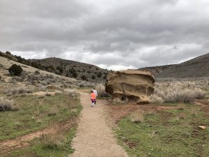
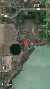
When we moved west of Utah Lake several years ago, I began to realize how good we had had it. We had lived 10 minutes from the Wasatch, able to quickly zip up to the mountains anytime. Suddenly we were 30-45 minutes from the same trails we had visited, and coordinating hikes took much more effort and planning. We’ve also been fairly limited in where we can hike as much of the land over here is privately owned. Luckily for us, though, the Eagle Mountain Bike Park is BLM land and is open to hikers as well as mountain bikers (and ATVs). We can reach a couple of the trailheads from our home. For this area, there isn’t a specific starting point to begin at. There are a several and they all intermingle.


OVERVIEW
Where: Eagle Mountain Ranches Area
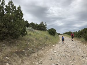
Grown up difficulty: easy besides the initial incline
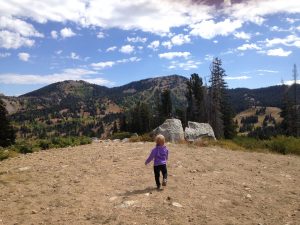
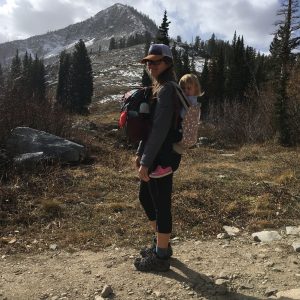
Five year old difficulty: medium due to the initial incline
Length and elevation: as short or long as you’d like. It’s an out and back
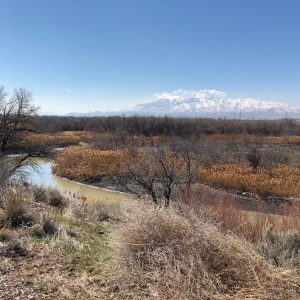
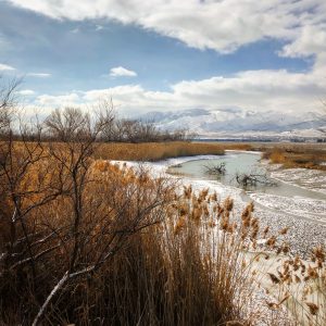
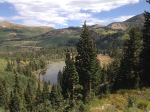
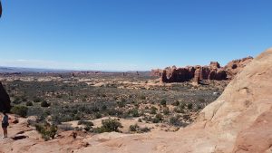
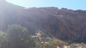
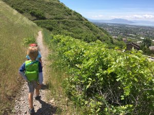
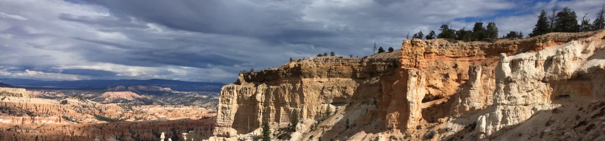
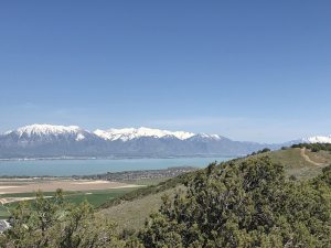
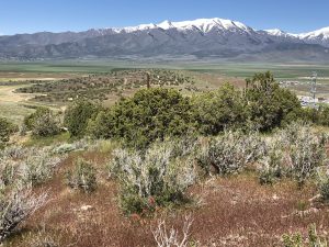
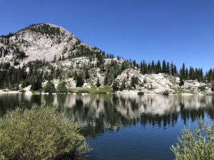
To see: views of Utah Lake, Lake Mountain, as well as the Eagle Mountain/Cedar Valley
Busyness: generally empty, some mountain bikers and ATVers
AllTrails: https://www.alltrails.com/trail/us/utah/eagle-mountain-loop

DETAILS
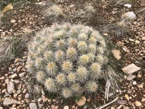
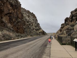
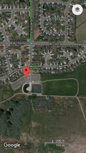
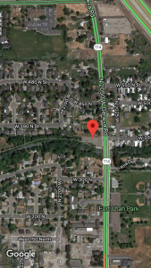
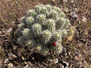
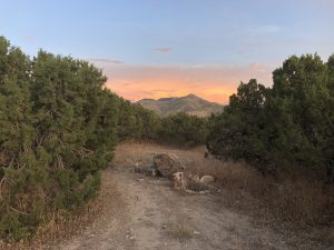
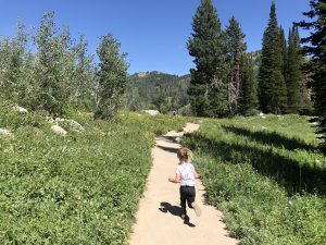
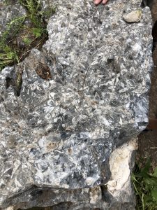
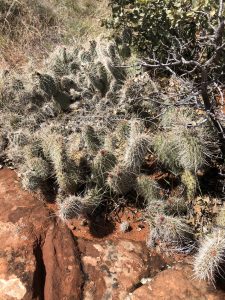
We usually start by one of these: Hidden Hollow Elementary, the trailhead off of Golden Eagle Road, or between homes on North Pointe Lookout Road. Our go to is the one on North Pointe Lookout Road, which takes you under the power lines. This is the steep part. In the summer, keep an eye on the sides of the trail as we’ve seen flowering cactus! Such a treat.

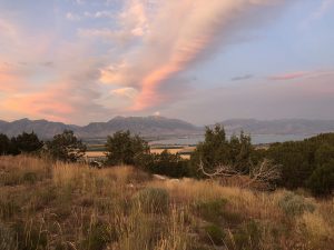
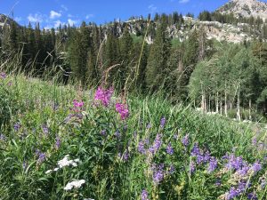
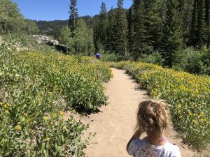
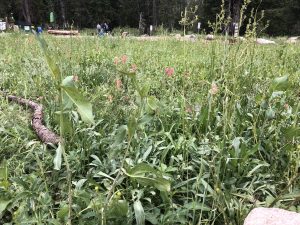
We have also identified flax, desert paintbrush, cliffrose, coral globemallow, and others. I honestly was so surprised by diversity of wildflowers here. Hawks and turkey vultures frequent the airspace here. There are excellent views of both Utah Lake, the southern Wasatch Front, the Oquirrh range, and Utah and Cedar valleys.

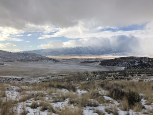
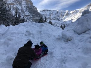
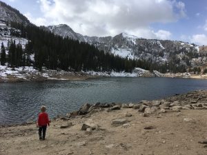
There is *no* shade, so make sure you bring plenty of water especially on hot days. It’s a lovely hike on overcast, cooler days, and in the winter. Bring spikes just in case during the winter.

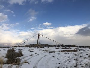
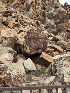
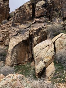
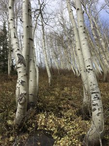
If you take trails over to the southwest of Hidden Hollow, you’ll come across a Tibetan prayer flag setup that is a beautiful little picture in the desert. All parts of these hills are covered with sage and juniper, and in the winter we’ve seen deer and rabbit tracks. Watch out for bikers and ATVers.

REVIEW
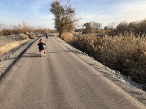
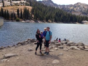
I love that this hike is walking distance from my home. I don’t have to drive over to the trailhead if I don’t want to. I’ve hiked as little as a mile and up to 5 miles solo. Sunsets and sunrises are especially beautiful here.
Faves: wildflowers and views
Hardest: the incline
Gear: water water water, spikes in the winter, and during wildflower season we bring our identification booklets .

Lake Mary, Brighton Ski Area

It’s still wildflower season up in the Wasatch Mountains. Lake Mary is a favorite of ours. Similar to Cecret Lake, the trailhead is at the end of a canyon road (though here you have the chance to drive through the peaks over into Park City). Big Cottonwood Canyon is a longer and less steep drive than Little Cottonwood Canyon.

OVERVIEW

Where: Big Cottonwood Canyon, edge of Brighton Ski Resort

Grown up difficulty: medium

Five year old difficulty: medium to hard

Length and elevation: 2.4 miles with 850 ft gain

To see: wildflowers, the lake, rock slides across the lake, a dam

Busyness: busy

AllTrails: https://www.alltrails.com/trail/us/utah/lake-mary-trail

DETAILS

The trailhead begins right by Brighton Mountain Sports. It’s fairly well marked and Google Maps displays it clearly. It’s just over a mile to the lake, but that mile is steep in places and unshaded for most. The meadows are full force during the summer months, and so are mosquitoes. Bring repellent!

You’ll hike underneath a ski lift and around a large granite boulder for the first half. There are a couple spots with shady trees where we rest and drink water. After this, it’s exposed until you get to the forest.

Walking through the rocky trail, you’ll pass a split off for Dog Lake (.1 miles if you want to tack that on!) and a small bridge over a pond a bit after. Right now there are tons of yellow Prairie Sunflowers on both sides of the trail. Soon you’ll see the large wall of the dam with the metal fencing on top. You’re almost there!

You’ll follow the dam along the edge, climbing up to the lake. Several streams cross the trail, so be careful or be ready to get wet. Soon you’ll reach the top and cross over the edge of the dam to the lake. This year the water is very high and beautiful. This is a watershed, so no dogs or swimming to protect our drinking water.

Watch out for the squirrels! These guys are very aggressive and will come really close as you rest and snack. Sometimes we stop here for good, and sometimes we continue on to Lake Martha and Lake Catherine. I feel like the hike to Lake Mary is the hardest part of the three lakes, but don’t let that deter you. Stop here if that’s what works for you.

REVIEW

We love this hike. It can be daunting with the elevation gain with the shorter distance, but the reward is a stunning alpine lake. It took us about 40 minutes to get to the lake the last time we hiked it.

Hardest: exposed trail, mosquitoes and heat depending on the time of year

Faves: wildflowers, deer, the lake

Gear: carrier if needed (I love my Kinderpack!), water, bug spray, water shoes

Cecret Lake

If you’re looking for streams, wildflowers, fossils, and a lake, this is the hike for you. The basin is truly breathtaking and the air is so cool up here. During the week, Alta charges $8/car to park at the Cecret Lake Trailhead. Starting the hike from this location means a 1.7 mile hike with just under 500 ft elevation gain. Plan on a longer hike if you’d like to walk around the lake (it’s gorgeous!). If you start from the Albion Basin, there is no charge for parking and the hike is closer to 5 miles round trip with around 1200 ft gain. We try to start at the Cecret Lake Trailhead as it’s a lot more doable for kids.

OVERVIEW

Where: Little Cottonwood Canyon, the last parking lot of Alta’s Summer Road

Grown up difficulty: easy

Five year old difficulty: easy

Length and elevation: 1.7 miles with around 500 ft gain

To see: wildflowers, streams, deer, moose, the lake, snow

Busyness: well traveled, busy on weekends for sure

AllTrails: https://www.alltrails.com/trail/us/utah/cecret-lake-trail

DETAILS

Firstly, mosquitos. Be prepared with spray or whatever repellent you choose to use. The trail is well marked with wooden signs pointing the way. There is a campsite at the trailhead as well with a pit toilet. There is limited parking (though they’ve added an extra lot!) so coming early is best. You will cross a few streams on your way to the lake.

Most of the trail is through wildflower fields, surrounding you in yellow, green, blue, purple, and pink. We even have seen a marmot! On the east side of the trail around the part where the trail and service road are the same is a big rock with fossils on it. Try to find it! We love it. The last bit of the trail is up a granite hill with two switchbacks. You can hike around the lake on a fairly well marked trail. There are fun rocks to scramble around on near the lake on the west side and some great places for picnics too. Just watch out for the alpine squirrels! They want all your food.

REVIEW

Such a fun summer hike. We’ve done it in the fall as well during Snowbird’s Oktoberfest and while the flowers are gone, it’s a lot emptier. With a child in a carrier the switchback portion will be more difficult, but my 7 and 4 year olds hiked it happily.

Hardest: mosquitos and switchbacks

Faves: the streams, wildflowers, and cooler air

Gear: mosquito repellent, waterproof or water shoes, snacks, water

Snow Canyon State Park

The day after we explored the Parowan Gap, we headed south to Snow Canyon State Park. We were looking for sun and warmer temperatures, and hoping for smaller crowds. I think we made a great choice.

My family had not been to Snow Canyon before, and we decided the night before to visit this state park which left us slightly unprepared. We managed to have fun still, and that was a good lesson for me (the chronic over-preparer). The temperature climbed 10-15 degrees as we descended into St. George. We drove through the red rocks into the north entrance of the park. Pro tip: they don’t take credit cards at the gate, so bring cash if you have it!

We stopped at the teeny visitor’s center to pay our fee, use the bathrooms, and to see if there were any stickers the kids liked enough to add to our collection. Then we drove back up to the Butterfly Trails. I’m not sure how long this hike technically is, as we really struggled to stay with the trail markers and ended up on a different trail altogether-the Petrified Dunes Trail.

These dunes were fantastic. The kids loved exploring around, looking at the different vegetation (I just read that the annual rainfall in Snow Canyon is just 7.5 inches a year!), and finding the unusual to us trail markers. We gained and lost a lot of elevation as we traveled to the end point of the dunes trail. This was the first hike where everyone carried their own lunch and we stopped to eat together. It was really nice to not be the designated carrier!

We chatted with a Friend of Snow Canyon volunteer who told us how the visitation numbers have exploded in recent years. They’ve expanded their trail system and are working on expanding the parking options, as the lots fill up by 11AM many days.

After this hike we headed down to Jenny Canyon. This tiny hike is a fun slot canyon, and it gave us a good taste of how fun sandstone can be. This hike only took 10-15 minutes, after which we headed across the street to the actual sand dunes.

All of the sand was heaven for the kids. It had warmed up greatly by this point and the sky was mostly clear. We spent a couple hourshere, building sand castles and playing frisbee. It was near the end of this where I realized none of us had sunscreen on and that I hadn’t even thought to bring it! We won’t forget next time, especially with how burned my husband got.

Next time we visit, I’d like to see the lava tubes and Johnson Canyon, as well as try to make it out to some petroglyphs the volunteer told us about. Snow Canyon is now one of my favorite places and I think my kids will remember the sand dunes if nothing else for a long time.

Parowan Gap

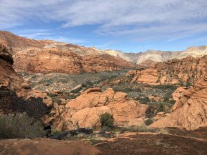
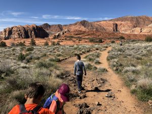
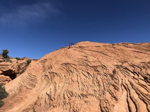
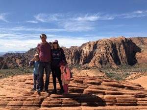
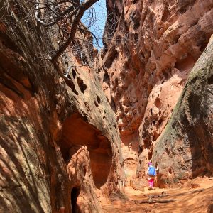
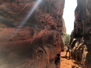
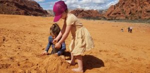
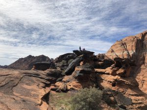
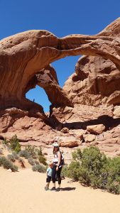
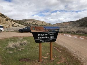
In March, we had family in town with cousins similar in age to my kids. They love adventures too so we decided to meet down in southern Utah and have ourselves a good time. I have a couple of friends who have spent a lot of time down south near St. George, so I reached out to them for some ideas. Word of mouth helps so much.

We got an AirBNB in Cedar City, to save a little bit of money and to be away from most crowds. I didn’t realize it was spring break for many students (my kids and their cousins are homeschooled so it’s not applicable over here) but I was so pleased with our lodging and our destination choices. Have you used AirBNB? It is my favorite way to travel.

On the drive to Cedar City, we stopped in Parowan to see two big attractions: dinosaur tracks and petroglyphs. Just a few miles off the highway is a cliffside on BLM land that has several fossilized dinosaur tracks. Seeing dinosaur tracks in real life, and being able to compare our hands to their size, was just fascinating. The kids climbed all around on the rocks and my husband who works with geologists pointed out many spots where fossils may be hiding underneath other layers of rock.

Next we headed down the road to the Parowan Gap petroglyphs. We had seen petroglyphs in Moab, on the Delicate Arch trail, a few years back, but this was just fascinating. We talked about how each culture and religion has it’s own creation story and ways of explaining things that happen.

My kids didn’t quite grasp how new email and phones are (hi I clearly remember the sound of dial up and how I’d get yelled at when someone picked up the corded phone to call out and heard the internet sound), but we talked about how the petroglyphs were ways to communicate and to document experiences and thoughts. It was a good opportunity too to show my children how not everything is for us. We don’t really understand the glyphs but that’s okay, we don’t need to.

The signs say the glyphs are from several different indigenous groups from around a 1,000 year time frame. We used this opportunity to talk more about Leave No Trace.

Here are a few more resources about the Parowan Gap:

https://utah.com/parowan-gap

https://parowan.org/parowan-gap/

https://geology.utah.gov/map-pub/survey-notes/geosights/parowan-gap/

https://www.blm.gov/visit/parowan-gap

#NotHiking

This winter is lasting a long time! We’ve had quite a bit of avalanche danger the last few months, and because I have small kids and minimal avalanche preparedness training, we’ve been avoiding hiking in the mountains to keep safe. We homeschool and hiking is a pretty integral part of our weekly routine, so we’ve had to make adjustments. Here are some ideas if you’re going through similar frustrations.

Paved Trail Walks

I have a list here of different valley trails we really like around Utah County. If you search my “accessible” tag, you’ll find some more paved trails. My kids have really enjoyed riding their bikes along the Utah Parkway Trail, which connects travels fairly close to Utah Lake. While the lake is really quite gross, it looks beautiful from a small distance. Other options are the Jordan River Parkway which has many different locations you can drop in from, and parts of the Provo River Trail. The Cedar Hills Parkway Trail is gorgeous as well.

Watercolor

A year or so ago we bought IKEA’s watercolor palettes and cardstock paper. These non expensive products work quite well for my kids! We’ve been following YouTube tutorials by Let’s Make Art and my 7 and 4 year olds have been able to follow along. My 4 year old has a bit of a harder time but is definitely engaged and interested for the first 15-20 minutes. I started watercoloring last year with Michael’s Artist Loft brand of watercolors, brushes, and paper. Sarah Cray of Let’s Make Art has done a phenomenal job of making watercoloring accessible to many of us. Try it out!

Drawing

My son LOVES Art for Kids Hub, also on YouTube. The supplies list is small, too! Permanent markers, paper, and colored pencils are all you need. The host is so kind and encouraging and really great with kids. He’s a father who draws with his kids, and he gives kids a lot of confidence in their skills. My son has loved displaying his artwork in our living spaces and talking about drawing them.

Parks

We play at our neighborhood park most days, even in the snow. It’s right outside our house, so we put on our snow clothes when we need to and head out. I walk around the perimeter for my own exercise and my kids get to play. As long as the wind isn’t strong and it’s at least 15 degrees, we’ve played at this park. Use Google Maps to find new parks near you and check them out. My kids like to build snowmen at parks.

Cosmic Kids Yoga

YouTube again, for the win! Cosmic Kids Yoga practices are so kid friendly. She’s engaging and expressive and fun. My daughter requests Cosmic Kids several times a week and she has dozens to choose from, with time frames of 15-45 minutes. It’s a great way to get exercise in as well as work on breathing, mindfulness, and strength.

Sledding

We have a couple of spots that we love sledding at. Well, my kids and husband enjoy sledding at. I’m not huge into sledding, so I prefer to snowshoe around while they play. Win win, right? One spot is right off of Big Cottonwood Canyon Road, near the Jordan Pines campground. We also like sledding at the Stewart Falls trailhead. There are decent hills and sometimes there are no other people around.

Today we went on a walk and saw leaf buds on trees, so spring is so close. What tips do you have for getting through the last bit of winter?

Twin Lakes

Twin Lakes is one trail option that branches off from Silver Lake, the accessible one up at Brighton Ski Resort. Twin Lakes climbs above Silver Lake on a decently steep slope, presenting you with beautiful views first of the lake and then the surrounding valley. It is a fairly exposed hike, but the lake is really quite pretty.

OVERVIEW

Where: Brighton Ski Resort, starting from the back of Silver Lake

Grown up difficulty: easy to medium

Kid difficulty: medium to hard

Length and elevation: 760 ft up, 2.3 miles out and back

To see: lakes, trees, granite rocks

Busyness: medium to heavy

AllTrails: https://www.alltrails.com/trail/us/utah/twin-lakes

DETAILS

This hike starts at the back of Silver Lake. My post here covers Silver Lake pretty thoroughly. We’ve seen moose here on the boardwalk a few times, and the kids love to watch the fish in the water. At the backside of the lake, once you’ve hit dirt trail, there is a branch off for Twin Lakes and Lake Solitude. Twin Lakes heads to the left and Lake Solitude continues straight. Take the left branch, up the side of the mountain that borders Silver Lake.

This portion of the hike is quite exposed and the slope can be steep at times. If it’s near freezing, consider spikes and hiking sticks for your safety. You’ll hike through small boulder fields and evergreens, and get to see signs of ski season. Of course, the view is enhanced with the elevation gain, as the valley and mountains around Brighton are picturesque. Twin Lakes is a reservoir, so toward the end you’ll see signs of that, like metal railings around the edge of it.

At the lake, we like to explore a bit and have our snacks. The pines and firs around it bring a heavenly scent to the area.

REVIEW

This hike is one of the harder ones my kids have done. We’ve had a decent amount of whining with the combination of exposure and elevation gain. They love throwing rocks in the lake at the top, and you deserve a good break there after the climb (especially when you have to carry the snacks, water, and the child!). Use your distraction toolbox (friends, snacks, songs, games) and point out the different plants, animals, and bugs you see. If you can take friends along, do that!

Faves: the lakes, wildlife, trees

Hardest: exposure and climb

Gear: good shoes, snacks, water, possibly spikes and hiking sticks

Arches National Park-Day Trip

It’s halfway through April and we woke up to three inches of snow. This past winter has been all over the place, and while I’m trying to embrace what is, I just can’t wait for warmer weather. Two years ago this month we took a quick day trip to Arches National Park. At the time we had a four and one year old, a somewhat unreliable car, and didn’t want to mess with bedtime out of our home. Day trip it was!

We scoured some pages on nps.gov and maps to see what we could fit in with just a few hours in the park. Our oldest had a limit of 2-3 miles at the time, but we wanted the 7 total hours in the car to be worth it. We left early in the morning with lunch and snacks packed, lots of water, and sunscreen.

Our first stop once we were in the park was Double Arch and The Windows Section. The total was around a mile and a half round trip to two beautiful, tall arches that touch on one end, and then up close to a couple window-like arches. It took us an hour or so, including hiking and gazing in awe.

Next we had lunch and then drove through the park while the 4 year old rested. The baby fell asleep, so we parked at the trailhead for the Sand Dune Arch. She and I waited in the car while my husband and oldest did this 20 minute, third of a mile hike together.

Our last stop was our biggest, an hour long hike to Landscape Arch. This was the toughest as my oldest had already hiked a couple miles and was hot and tired. We went slowly, letting him play in the soft sand and pause in the rare shade. This hike is around 1.5 miles round trip and we drank plenty of water during this one.

After our last hike, we hit up a Mexican restaurant in Moab and headed home. It was a lot of driving, but a great trip for our family at the time. Two years later my son still remembers the arches and wants to go back. Hopefully we can revisit this year and explore even more.

Gear

Bring water! We have a few hydration backpacks (Camelbak, Osprey) and water bottles (love my Hydroflask for hiking). Snacks and lunch, sunscreen, hats and sunglasses are pretty necessary in the desert. Good shoes too, as hiking in sand can be more demanding than harder surfaces. At the time my one year old was in an Ergo Ventus which worked great for her size.

5 Trails for When the Weather is Sketchy

This winter has had such weird weather. We’ve had a mostly mild one, but then the last couple of months the snow has dumped and melted, dumped and melted. The ups and downs have made for a high avalanche risk in the backcountry, and above certain elevations.

I’m not trained whatsoever in avalanche safety, so we’ve stuck to foothills and west/south facing trails, as well as paved ones. We have still been able to get outside for the most part, but have been playing it very safe. Here are some of our favorites! I’ll do individual, more detailed posts later, but this is a primer.

  1. Jordan River Trail. This paved trail is very close to our home, meanders along the river, and passes a remote control airplane park at the southernmost end. We’ve seen pelicans, cows, grass taller than us. I’ve heard there is a small set of hot springs at the very beginning of the trail, but we haven’t checked them out. We often start at Inlet Park in Saratoga Springs. 
  2. Utah Lake Parkway Trail. This  paved trail connects to the Jordan River Trail. It starts at North Lake Park in Lehi, in a small neighborhood. It passes fields, dense copses of trees, and abandoned structures. The hidden treasure though is the Utah Lake access trail. It’s short, unpaved, and super muddy. The mud is worth it (to me) to get down to the lake shore and get a nearly panoramic view of our valley. Bring something to deal with the muddy shoes after!
  3. Bonneville Shoreline Trail. Lake Bonneville existed until about 14,500 years ago. It covered the entire Salt Lake Valley and was about a third of the size of modern Utah. Because the lake existed for so long (it was formed around 500 million years ago!), significant deposits were left at various shorelines. The Bonneville Shoreline trail follows one of those. It has trailheads in most canyons throughout Utah County (I’ve started from Slate Canyon, Rock Canyon, east of Dry Creek Canyon). Use Google Maps to find a trailhead you want to use-the red pins are some options.
  4. Murdock Canal Trail. Another paved trail, this one sits atop the Murdock Canal. It’s pretty flat and open. Great for bikes, strollers, roller blades, wheelchairs, etc. There are trailheads from 800 N Orem to Highland Glen Park. Another one to use Google Maps for!
  5. Provo River Trail, of course. This busy busy paved trail is a favorite of many Utahns. It looks to start at the north east end of Deer Creek, go downhill through Provo Canyon, and follow the river all the way to Utah Lake. We usually use the portions around Bridal Veil Falls, the mouth of Provo Canyon, and near Fort Utah Park on Geneva Road. It’s usually well shaded, and it’s fun to watch the river change through the seasons.

What are your favorite places when getting up into the mountains isn’t an option?

Upper Falls, Provo Canyon

One of my hiking buddies noticed a waterfall a little east of Bridal Veil falls last year. She figured out how to get there and my kids and I tagged along. This pleasant hike is mostly flat, along the Provo River Trail. After a mile or so from the trailhead, a small path branches off behind a stone building. A brief climb takes you to Upper Falls, with great views of the canyon.

OVERVIEW

Where: Provo Canyon, starting from the bridge by the dam east of the Bridal Veil parking lot

Grown up difficulty: easy

Five year old difficulty: easy

Length and elevation: around 3 miles round trip with around 500 ft gain, depending where you park

To see: river, waterfall, cool rocks

Busyness: Provo River Trail is quite busy, but this branch off is not

Alltrails: https://www.alltrails.com/trail/us/utah/upper-falls

DETAILS

Provo River Trail is one of our favorite paved trails. There is a lot to see, especially with the river and waterfalls, and in the summer it is significantly cooler than the rest of the valley.

For this hike, you can make it longer (closer to 3 miles) by starting at the main parking lot for Bridal Veil falls and passing picnic areas. If you’re in a hurry, take the same exit, but drive the road that follows the river as far as you can. Cross the bridge, then hike east looking for a building covered in graffiti.

Behind the building is the dirt path that will take you to the waterfall. It is steep after this, but really short. We only saw 3-4 others on this part of the trail when we went.

There’s not really anywhere to sit and snack, but the water feels great during the hot summer, and my son loved checking out all of the different rocks.

REVIEW

Faves: waterfalls! My kids do great when a waterfall is the destination/

Hardest: the steepness

Gear: I need ankle support for steep hikes like this. Snacks, water, sunscreen will be helpful too.