Winter Hikes: Donut Falls

It’s been a minute! The last several months have been hard. I live with Generalized Anxiety Disorder, and while I’ve been in consistent therapy for a year now, the anxiety grew and grew during 2019. Now I’ve been on an SSRI for two full months, and I cannot believe how much better I feel. My thoughts aren’t racing, anxiety lasts during predictable moments but doesn’t extend to anticipatory anxiety or latent anxiety, and I’m sleeping so well. I’m so excited to see how 2020 goes with this shift in mental health.

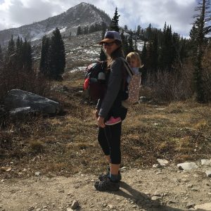
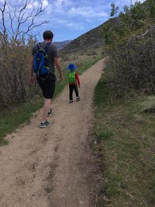
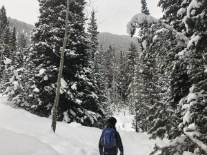
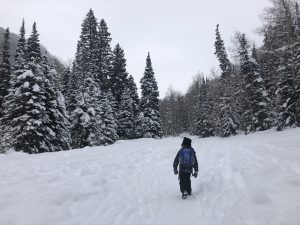
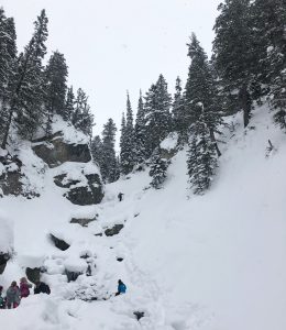
So, Donut Falls! I posted about hiking it here during the warmer seasons, and recently we went up with friends in January. It was lovely and not nearly as difficult as I anticipated. My kids are now just about 8 and 5, and both did it with just a bit of whining. Here’s a review of this hike from a snowy perspective.
OVERVIEW

Where: Big Cottonwood Canyon, SLC. About halfway up.

Grown up difficulty: easy

Five year old difficulty: medium due to hiking in snow and starting out at the road

Length and elevation: AllTrails says 3.3 miles round trip, 550 ft gain

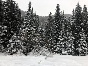
To see: foliage, river, waterfall, snow covered evergreens, animal tracks

Busyness: busy at the beginning, but thins out quite a bit

AllTrails: https://www.alltrails.com/trail/us/utah/donut-falls-trail
DETAILS

In winter, this hike begins by the road where you’ll see a lot of people sledding, taking pictures, and playing around. The road is pretty icy past the gate, and the signs indicate that sledding and skiing on the actual road is prohibited. Wearing spikes isn’t a bad idea. The road is on an incline, and after a turn climbs through beautiful tall trees. Make sure you and your littles have appropriate cold weather clothes on. If you need a reminder, I’ve got a post here and here to help. We also bring hand warmers along.
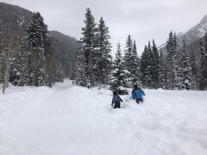
 

You’ll pass some cozy (sometimes huge) cabins tucked away on side roads as you approach the true trailhead. You’ll see the trailhead at the small bathroom and signs. We didnt need snowshoes up to this point, and for the most part we did fine without them. In the snow sound carries well, so you’ll hear if there are others around the trail. You’ll walk across a bridge and turn toward the end of the hike. At the climb down to the river, we had the kids sit down again. I had spikes on and did okay. The river was fully frozen over, but we still kept close eyes on the kids and had them stick to where others had hiked.

We got to the white placard and my husband climbed to the donut, while the rest of us stayed down. Our friends had microspikes for their whole family and made it up to the donut and back safely. I’m just too cautious for that type of thing. We saw a small fraction of the amount of people we normally see on this hike and it was lovely.
REVIEW

We had a blast exploring this area during the winter. Usually we stay near the road sledding, and venturing back was rewarding. Check for avalanche danger before you go, too.

Faves: waterfall, identifying animal tracks, snow covered evergreens

Hardest: climbing down to the river

Gear: for winter, carry spikes and/or snowshoes, hiking poles, and wear full winter gear

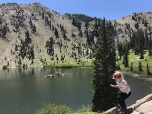
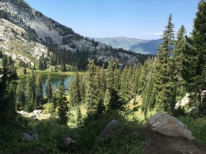
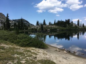
Lakes Mary, Martha, and Catherine

Check here for a post on Lake Mary! We love visiting all three sister lakes when we come up to Brighton. I believe getting to Lake Mary is the most difficult, and it’s really smooth sailing after that.

OVERVIEW

Where: Big Cottonwood Canyon, edge of Brighton Ski Resort

Grown up difficulty: medium

Five year old difficulty: medium to hard
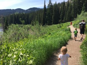
Length and elevation: 4.4 miles and 1250 ft gain

To see: wildflowers, three lakes, moose, rocks to climb

Busyness: busy

AllTrails: https://www.alltrails.com/trail/us/utah/lake-catherine-via-brighton-lakes-trail

DETAILS

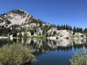
You’ve already made it to the first, hardest lake, Lake Mary! Congrats. It’s shady now, with truly spectacular views. After resting at the first lake, you’ll follow the trail around the lake, heading away from the dam in the same direction you came up. The trail climbs, giving an excellent top view of the lake. Lake Martha comes up really quickly on your right. It’s smaller, off the trail a ways, and often has a moose grazing nearby.
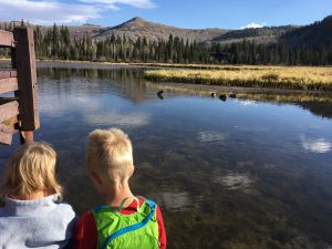
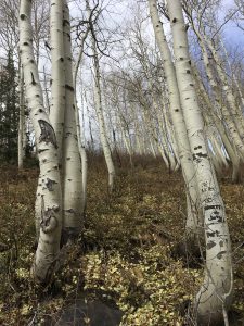
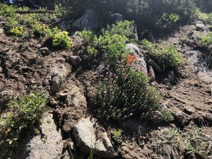
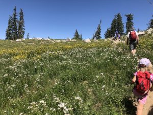
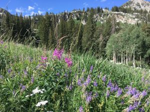
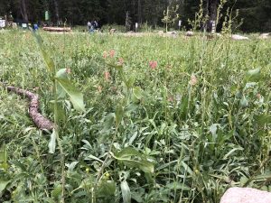
There’s more wildflowers here, including paintbrush, lupine, asters, and bluebells. It’ll open back up after awhile as you hike higher, through a switchback, and then to another meadow.

Our kids love climbing around on the boulder field right before Lake Catherine. There are some beautiful views here of the other two lakes as well as the Big Cottonwood Canyon. The trail splits and either way will take you to the last lake.

Once here, we take a really long break. You’ve just hiked over two miles and you may have some whiny kids. Plus the rest is mostly downhill and your toes are going to get tired. We’ve seen moose here as well.

REVIEW

Such a beautiful area and hike. If you’re up for a longer, steeper hike, tack on Lake Martha and Lake Catherine to your Lake Mary hike. I don’t think you’ll regret it.

Faves: wildflowers, three lakes, streams, shady areas

Hardest: length

Gear: good shoes and socks, water, snacks

Lake Mary, Brighton Ski Area

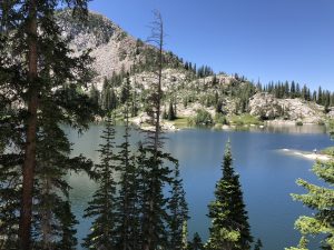
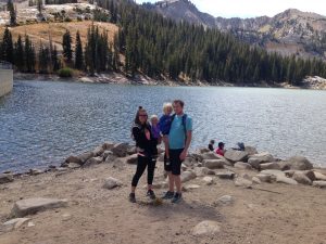
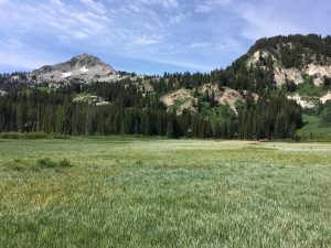
It’s still wildflower season up in the Wasatch Mountains. Lake Mary is a favorite of ours. Similar to Cecret Lake, the trailhead is at the end of a canyon road (though here you have the chance to drive through the peaks over into Park City). Big Cottonwood Canyon is a longer and less steep drive than Little Cottonwood Canyon.

OVERVIEW

Where: Big Cottonwood Canyon, edge of Brighton Ski Resort

Grown up difficulty: medium

Five year old difficulty: medium to hard

Length and elevation: 2.4 miles with 850 ft gain

To see: wildflowers, the lake, rock slides across the lake, a dam

Busyness: busy

AllTrails: https://www.alltrails.com/trail/us/utah/lake-mary-trail

DETAILS

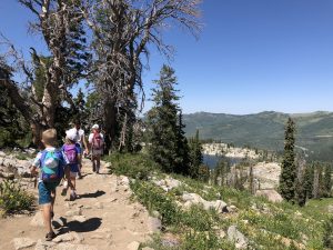
The trailhead begins right by Brighton Mountain Sports. It’s fairly well marked and Google Maps displays it clearly. It’s just over a mile to the lake, but that mile is steep in places and unshaded for most. The meadows are full force during the summer months, and so are mosquitoes. Bring repellent!

You’ll hike underneath a ski lift and around a large granite boulder for the first half. There are a couple spots with shady trees where we rest and drink water. After this, it’s exposed until you get to the forest.

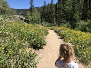
Walking through the rocky trail, you’ll pass a split off for Dog Lake (.1 miles if you want to tack that on!) and a small bridge over a pond a bit after. Right now there are tons of yellow Prairie Sunflowers on both sides of the trail. Soon you’ll see the large wall of the dam with the metal fencing on top. You’re almost there!

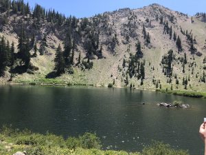
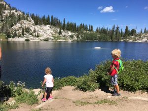
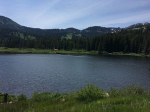
You’ll follow the dam along the edge, climbing up to the lake. Several streams cross the trail, so be careful or be ready to get wet. Soon you’ll reach the top and cross over the edge of the dam to the lake. This year the water is very high and beautiful. This is a watershed, so no dogs or swimming to protect our drinking water.

Watch out for the squirrels! These guys are very aggressive and will come really close as you rest and snack. Sometimes we stop here for good, and sometimes we continue on to Lake Martha and Lake Catherine. I feel like the hike to Lake Mary is the hardest part of the three lakes, but don’t let that deter you. Stop here if that’s what works for you.

REVIEW

We love this hike. It can be daunting with the elevation gain with the shorter distance, but the reward is a stunning alpine lake. It took us about 40 minutes to get to the lake the last time we hiked it.

Hardest: exposed trail, mosquitoes and heat depending on the time of year

Faves: wildflowers, deer, the lake

Gear: carrier if needed (I love my Kinderpack!), water, bug spray, water shoes

Cecret Lake

If you’re looking for streams, wildflowers, fossils, and a lake, this is the hike for you. The basin is truly breathtaking and the air is so cool up here. During the week, Alta charges $8/car to park at the Cecret Lake Trailhead. Starting the hike from this location means a 1.7 mile hike with just under 500 ft elevation gain. Plan on a longer hike if you’d like to walk around the lake (it’s gorgeous!). If you start from the Albion Basin, there is no charge for parking and the hike is closer to 5 miles round trip with around 1200 ft gain. We try to start at the Cecret Lake Trailhead as it’s a lot more doable for kids.

OVERVIEW

Where: Little Cottonwood Canyon, the last parking lot of Alta’s Summer Road

Grown up difficulty: easy

Five year old difficulty: easy

Length and elevation: 1.7 miles with around 500 ft gain

To see: wildflowers, streams, deer, moose, the lake, snow

Busyness: well traveled, busy on weekends for sure

AllTrails: https://www.alltrails.com/trail/us/utah/cecret-lake-trail

DETAILS

Firstly, mosquitos. Be prepared with spray or whatever repellent you choose to use. The trail is well marked with wooden signs pointing the way. There is a campsite at the trailhead as well with a pit toilet. There is limited parking (though they’ve added an extra lot!) so coming early is best. You will cross a few streams on your way to the lake.

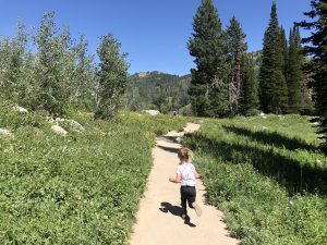
Most of the trail is through wildflower fields, surrounding you in yellow, green, blue, purple, and pink. We even have seen a marmot! On the east side of the trail around the part where the trail and service road are the same is a big rock with fossils on it. Try to find it! We love it. The last bit of the trail is up a granite hill with two switchbacks. You can hike around the lake on a fairly well marked trail. There are fun rocks to scramble around on near the lake on the west side and some great places for picnics too. Just watch out for the alpine squirrels! They want all your food.

REVIEW

Such a fun summer hike. We’ve done it in the fall as well during Snowbird’s Oktoberfest and while the flowers are gone, it’s a lot emptier. With a child in a carrier the switchback portion will be more difficult, but my 7 and 4 year olds hiked it happily.

Hardest: mosquitos and switchbacks

Faves: the streams, wildflowers, and cooler air

Gear: mosquito repellent, waterproof or water shoes, snacks, water

Twin Lakes

Twin Lakes is one trail option that branches off from Silver Lake, the accessible one up at Brighton Ski Resort. Twin Lakes climbs above Silver Lake on a decently steep slope, presenting you with beautiful views first of the lake and then the surrounding valley. It is a fairly exposed hike, but the lake is really quite pretty.

OVERVIEW

Where: Brighton Ski Resort, starting from the back of Silver Lake

Grown up difficulty: easy to medium

Kid difficulty: medium to hard

Length and elevation: 760 ft up, 2.3 miles out and back

To see: lakes, trees, granite rocks

Busyness: medium to heavy

AllTrails: https://www.alltrails.com/trail/us/utah/twin-lakes

DETAILS

This hike starts at the back of Silver Lake. My post here covers Silver Lake pretty thoroughly. We’ve seen moose here on the boardwalk a few times, and the kids love to watch the fish in the water. At the backside of the lake, once you’ve hit dirt trail, there is a branch off for Twin Lakes and Lake Solitude. Twin Lakes heads to the left and Lake Solitude continues straight. Take the left branch, up the side of the mountain that borders Silver Lake.

This portion of the hike is quite exposed and the slope can be steep at times. If it’s near freezing, consider spikes and hiking sticks for your safety. You’ll hike through small boulder fields and evergreens, and get to see signs of ski season. Of course, the view is enhanced with the elevation gain, as the valley and mountains around Brighton are picturesque. Twin Lakes is a reservoir, so toward the end you’ll see signs of that, like metal railings around the edge of it.

At the lake, we like to explore a bit and have our snacks. The pines and firs around it bring a heavenly scent to the area.

REVIEW

This hike is one of the harder ones my kids have done. We’ve had a decent amount of whining with the combination of exposure and elevation gain. They love throwing rocks in the lake at the top, and you deserve a good break there after the climb (especially when you have to carry the snacks, water, and the child!). Use your distraction toolbox (friends, snacks, songs, games) and point out the different plants, animals, and bugs you see. If you can take friends along, do that!

Faves: the lakes, wildlife, trees

Hardest: exposure and climb

Gear: good shoes, snacks, water, possibly spikes and hiking sticks

Donut Falls

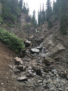
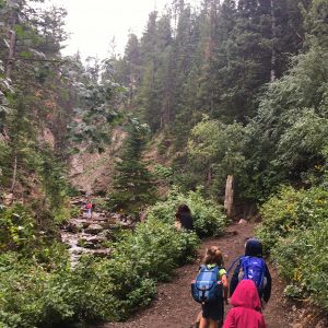
It’s been so hot in the valley that hiking is difficult. I know summer (especially high summer) is temporary, but avoiding sunburns and heat exhaustion is priority right now, while still enjoying the varying landscape. This week we went up to Donut Falls in Big Cottonwood Canyon. Due to morning swim lessons, we went in the afternoon, but thanks to afternoon thunderstorms the temperature was excellent.

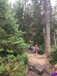
We got to the trailhead around 12:30pm. This hike is easy and short with lots and lots of tree coverage. My 3.5 year old didn’t complain once, which was great because I ended up piggy backing my 6.5 year old after his shoe broke. This hike gets packed especially on weekends, so be prepared.

OVERVIEW

Where: Big Cottonwood Canyon, SLC. About halfway up.

Grown up difficulty: easy

Five year old difficulty: easy, as long as you start close to the actual trailhead

Length and elevation: AllTrails says 3.3 miles round trip, 550 ft gain

To see: foliage, river, waterfall

Busyness: BUSY. So so so busy.

AllTrails: https://www.alltrails.com/trail/us/utah/donut-falls-trail

DETAILS

Big Cottonwood Canyon is one of our favorite canyons. We go year round for hiking and for sledding and snow shoeing. This trail starts right before the Jordan Pines campground. There is a gate on the south side of the road that closes during winter. When it’s closed, your hike will start there. When the gate is open, drive through and park at the trailhead or anywhere close that parking is allowed.

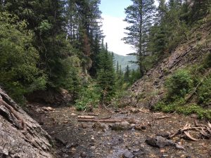
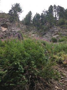
There are a couple of hills at the beginning of the hike, but otherwise it is fairly flat. We worked on our flower identification and saw cow parsnip, monkshood, bluebells, asters, and twin berries. On the way to the waterfall, some red peaked out of the green bushes and we found wild raspberries!

At the end of the hike, you have to climb down some rocks (maybe 15 ft worth) to get to the river. We all sat on our butts as the rocks were wet from rain, and no one got hurt. Be careful here with littles. Then you walk along the riverbank until the trail ends. Cross the river (this time of year it was shallow and quite cold) to the opposite side, where a white placard is posted. We let the kids snack and play in the water here and didn’t climb further.

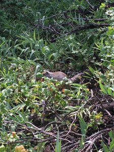
Alpine squirrels and chipmunks are all over this trail and they get super close to hikers. We didn’t feed them, but they tried to get into our packs when we set them down at the river. They can chew threw fabric so be aware!

I’m not comfortable taking my kids to the top, especially since I have fallen in a waterfall before, but tons of people do. The pictures look really neat.

REVIEW

This is a great little hike when you can start at the trailhead. Shaded, lots of foliage to point out (go in July if you want to see more flowers!), and waterplay. We made it there and back in about 2 hours, including a lot of time playing at the destination.

Faves: wild raspberries, waterfall, river

Hardest: climbing down to the river

Gear: shoes that can get wet, snacks, water, sunscreen

Accessible Hikes: Silver Lake Loop, Brighton

Before kids, I worked in Early Intervention. I helped provide developmental services to young children ages 0-3 with delays and disabilities. Some kids needed less support than others; some kids have lifelong needs. Several kids I worked with are in wheelchairs and always will be. When I’m in the mountains, those kids are often on my mind. Finding ways to share love of outdoors is important to me, and I wish the outdoors were less discriminatory. Being aware of wheelchair accessible hikes is important to me-please reach out to me if you know of some!

There are options, though. Paved trails are open to wheelchairs and bikes, and both Utah and Salt Lake Counties have some great ones. One is Silver Lake Loop, up at Brighton. This location is the trailhead for at least a few hikes, but the beginning is a loop around a lake that is open to all abilities. It is definitely wheelchair accessible. 

OVERVIEW

Where: Big Cottonwood Canyon, near the Nordic Center

Grown up difficulty: easy

Five year old difficulty: easy

Length and elevation: around 1 mile with a 50 foot elevation change

To see: wildflowers in the spring and early summer, lake, fish, aspens, moose sometimes

Busyness: busy on weekends

AllTrails: https://www.alltrails.com/trail/us/utah/silver-lake-loop-trail

SUMMARY

This hike is a hit for my kids. It’s wheelchair accessible, has a couple places to fish, and we’ve seen a moose here too! The wildflowers here in the summer are unbelievable-we got to see lots of elephants’ head and mountain bluebells in the spring.  We got a lot of use again out of our Pocket Naturalist Guidebook here as well. Oh also, Pokemon Go works here.

DETAILS

A lot of the hike is exposed, but there is a portion through the woods. We love watching the aspens change over the seasons, and there are some great climbing rocks around too. The mountainside of this trail branches off for hikes for Lake Solitude and Twin Lakes Reservoir. These are great hikes as well, but not wheelchair accessible.

This is such a good hike for beginners, for differently abled people, and for a quick trip up the mountains. Check out this blog post, where a family with a daughter in a wheelchair went to this trail.

REVIEW

Faves: aspens and water, short, little elevation gain

Gear: little to none! You can take a lot if you want, and none if you want. Strollers and wheelchairs can use this trail.

Bear Canyon Suspension Bridge

Overview

Where: Sandy, starting from Orson Smith Park

Grown up difficulty: moderate to easy

Five year old difficulty: same

Length and elevation: 2 miles, 450 ft elevation gain

To see: Salt Lake valley, cool bridges, river

Busyness: lightly trafficked to moderately trafficked

https://www.alltrails.com/trail/us/utah/draper-suspension-bridge

summary

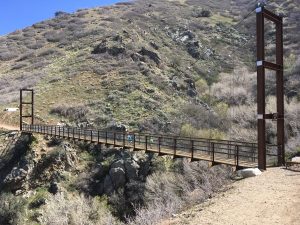
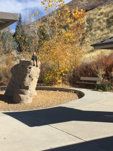
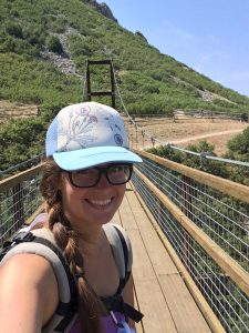
One of my friends recommended this hike to me. The alltrails for it looked amazing, so we made a local event and went! It was a blast. The beginning is switchbacks from a neat little kid centered rock climbing park, until you get to the Bonneville Shoreline trail. Then it’s pretty flat to get to the (rather large) suspension bridge. This is a very exposed trail, so dress accordingly.

details

I’ve only ever started at Orson Smith Park which has a couple of covered picnic tables, and a bathroom. To the immediate east is the trail. Several switchbacks have you gain elevation at a pretty good pace. After a few you’ll come to a flat trail. This won’t take you to the bridge-keep going up! The trail continues up more switchbacks until it reaches the Bonneville Shoreline trail.

This trail will take you slightly around the mountain, after passing a sign for Cherry Canyon Logging trail. Stay on the flat trail; don’t go up unless you want a much more intense hike. Pretty soon you’ll start to see glimpses of the bridge. I was stunned when I first saw it because it was much bigger than I expected.

My kids like to give me a heart attack and hop across the bridge. It is fun and a little trippy to walk across the bridge as it sways. We have a good time here and usually have snacks on a bench on the side of the bridge.

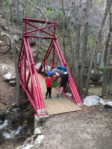
Then, we head up to another bridge! This one is just a couple minutes up from the suspension bridge. It’s little and painted red, and right over a small stream my kids like to play in when it’s warm.

When it’s warm out, this is a great shaded place to sit and eat lunch before heading down.

Review

Faves: the suspension bridge! Totally worth the effort to get to it.

Hardest: the switchbacks

Gear: a carrier if your child isn’t ready to hike alone (love my Kinderpack!), hydration pack/water bottles, hiking shoes or tennis shoes, snacks, hats, sunscreen