This winter has had such weird weather. We’ve had a mostly mild one, but then the last couple of months the snow has dumped and melted, dumped and melted. The ups and downs have made for a high avalanche risk in the backcountry, and above certain elevations.
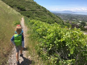
I’m not trained whatsoever in avalanche safety, so we’ve stuck to foothills and west/south facing trails, as well as paved ones. We have still been able to get outside for the most part, but have been playing it very safe. Here are some of our favorites! I’ll do individual, more detailed posts later, but this is a primer.
- Jordan River Trail. This paved trail is very close to our home, meanders along the river, and passes a remote control airplane park at the southernmost end. We’ve seen pelicans, cows, grass taller than us. I’ve heard there is a small set of hot springs at the very beginning of the trail, but we haven’t checked them out. We often start at Inlet Park in Saratoga Springs.

- Utah Lake Parkway Trail. This paved trail connects to the Jordan River Trail. It starts at North Lake Park in Lehi, in a small neighborhood. It passes fields, dense copses of trees, and abandoned structures. The hidden treasure though is the Utah Lake access trail. It’s short, unpaved, and super muddy. The mud is worth it (to me) to get down to the lake shore and get a nearly panoramic view of our valley. Bring something to deal with the muddy shoes after!
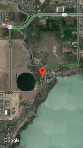
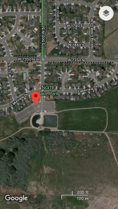
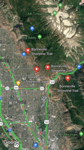
- Bonneville Shoreline Trail. Lake Bonneville existed until about 14,500 years ago. It covered the entire Salt Lake Valley and was about a third of the size of modern Utah. Because the lake existed for so long (it was formed around 500 million years ago!), significant deposits were left at various shorelines. The Bonneville Shoreline trail follows one of those. It has trailheads in most canyons throughout Utah County (I’ve started from Slate Canyon, Rock Canyon, east of Dry Creek Canyon). Use Google Maps to find a trailhead you want to use-the red pins are some options.
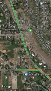
- Murdock Canal Trail. Another paved trail, this one sits atop the Murdock Canal. It’s pretty flat and open. Great for bikes, strollers, roller blades, wheelchairs, etc. There are trailheads from 800 N Orem to Highland Glen Park. Another one to use Google Maps for!
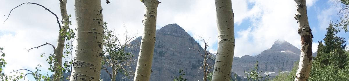
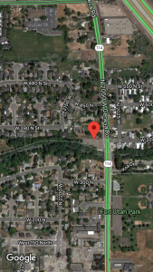
- Provo River Trail, of course. This busy busy paved trail is a favorite of many Utahns. It looks to start at the north east end of Deer Creek, go downhill through Provo Canyon, and follow the river all the way to Utah Lake. We usually use the portions around Bridal Veil Falls, the mouth of Provo Canyon, and near Fort Utah Park on Geneva Road. It’s usually well shaded, and it’s fun to watch the river change through the seasons.
What are your favorite places when getting up into the mountains isn’t an option?
One thought on “5 Trails for When the Weather is Sketchy”