Lakes Mary, Martha, and Catherine

Check here for a post on Lake Mary! We love visiting all three sister lakes when we come up to Brighton. I believe getting to Lake Mary is the most difficult, and it’s really smooth sailing after that.

OVERVIEW

Where: Big Cottonwood Canyon, edge of Brighton Ski Resort

Grown up difficulty: medium

Five year old difficulty: medium to hard

Length and elevation: 4.4 miles and 1250 ft gain

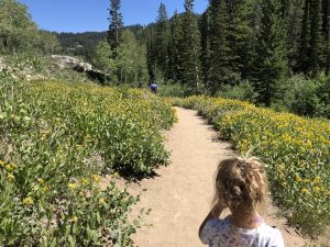
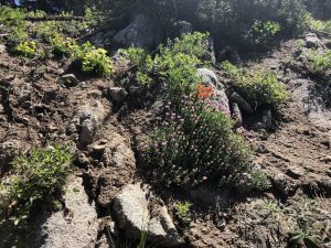
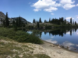
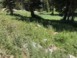
To see: wildflowers, three lakes, moose, rocks to climb

Busyness: busy

AllTrails: https://www.alltrails.com/trail/us/utah/lake-catherine-via-brighton-lakes-trail

DETAILS

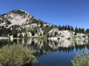
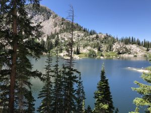
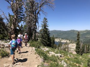
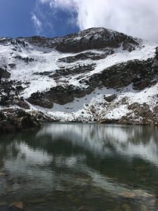
You’ve already made it to the first, hardest lake, Lake Mary! Congrats. It’s shady now, with truly spectacular views. After resting at the first lake, you’ll follow the trail around the lake, heading away from the dam in the same direction you came up. The trail climbs, giving an excellent top view of the lake. Lake Martha comes up really quickly on your right. It’s smaller, off the trail a ways, and often has a moose grazing nearby.

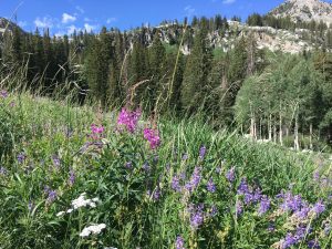
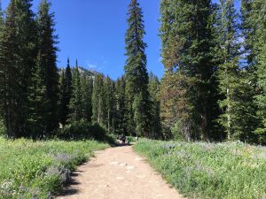
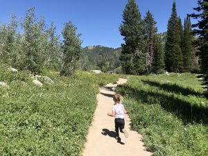
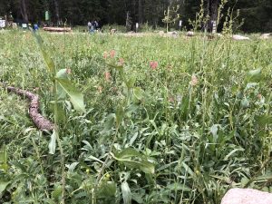
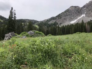
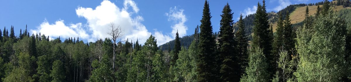
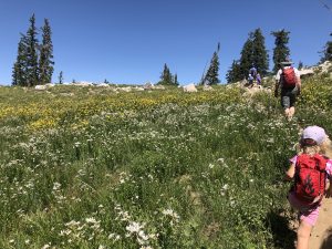
There’s more wildflowers here, including paintbrush, lupine, asters, and bluebells. It’ll open back up after awhile as you hike higher, through a switchback, and then to another meadow.

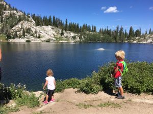
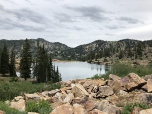
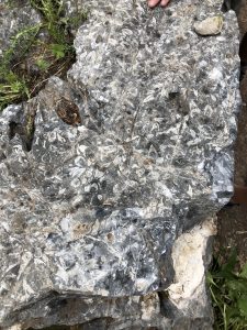
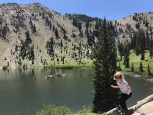
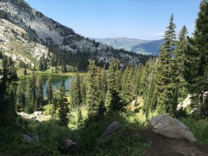
Our kids love climbing around on the boulder field right before Lake Catherine. There are some beautiful views here of the other two lakes as well as the Big Cottonwood Canyon. The trail splits and either way will take you to the last lake.

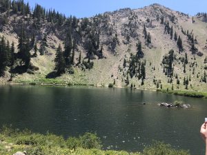
Once here, we take a really long break. You’ve just hiked over two miles and you may have some whiny kids. Plus the rest is mostly downhill and your toes are going to get tired. We’ve seen moose here as well.

REVIEW

Such a beautiful area and hike. If you’re up for a longer, steeper hike, tack on Lake Martha and Lake Catherine to your Lake Mary hike. I don’t think you’ll regret it.

Faves: wildflowers, three lakes, streams, shady areas

Hardest: length

Gear: good shoes and socks, water, snacks

Lake Mary, Brighton Ski Area

It’s still wildflower season up in the Wasatch Mountains. Lake Mary is a favorite of ours. Similar to Cecret Lake, the trailhead is at the end of a canyon road (though here you have the chance to drive through the peaks over into Park City). Big Cottonwood Canyon is a longer and less steep drive than Little Cottonwood Canyon.

OVERVIEW

Where: Big Cottonwood Canyon, edge of Brighton Ski Resort

Grown up difficulty: medium

Five year old difficulty: medium to hard

Length and elevation: 2.4 miles with 850 ft gain

To see: wildflowers, the lake, rock slides across the lake, a dam

Busyness: busy

AllTrails: https://www.alltrails.com/trail/us/utah/lake-mary-trail

DETAILS

The trailhead begins right by Brighton Mountain Sports. It’s fairly well marked and Google Maps displays it clearly. It’s just over a mile to the lake, but that mile is steep in places and unshaded for most. The meadows are full force during the summer months, and so are mosquitoes. Bring repellent!

You’ll hike underneath a ski lift and around a large granite boulder for the first half. There are a couple spots with shady trees where we rest and drink water. After this, it’s exposed until you get to the forest.

Walking through the rocky trail, you’ll pass a split off for Dog Lake (.1 miles if you want to tack that on!) and a small bridge over a pond a bit after. Right now there are tons of yellow Prairie Sunflowers on both sides of the trail. Soon you’ll see the large wall of the dam with the metal fencing on top. You’re almost there!

You’ll follow the dam along the edge, climbing up to the lake. Several streams cross the trail, so be careful or be ready to get wet. Soon you’ll reach the top and cross over the edge of the dam to the lake. This year the water is very high and beautiful. This is a watershed, so no dogs or swimming to protect our drinking water.

Watch out for the squirrels! These guys are very aggressive and will come really close as you rest and snack. Sometimes we stop here for good, and sometimes we continue on to Lake Martha and Lake Catherine. I feel like the hike to Lake Mary is the hardest part of the three lakes, but don’t let that deter you. Stop here if that’s what works for you.

REVIEW

We love this hike. It can be daunting with the elevation gain with the shorter distance, but the reward is a stunning alpine lake. It took us about 40 minutes to get to the lake the last time we hiked it.

Hardest: exposed trail, mosquitoes and heat depending on the time of year

Faves: wildflowers, deer, the lake

Gear: carrier if needed (I love my Kinderpack!), water, bug spray, water shoes

Cecret Lake

If you’re looking for streams, wildflowers, fossils, and a lake, this is the hike for you. The basin is truly breathtaking and the air is so cool up here. During the week, Alta charges $8/car to park at the Cecret Lake Trailhead. Starting the hike from this location means a 1.7 mile hike with just under 500 ft elevation gain. Plan on a longer hike if you’d like to walk around the lake (it’s gorgeous!). If you start from the Albion Basin, there is no charge for parking and the hike is closer to 5 miles round trip with around 1200 ft gain. We try to start at the Cecret Lake Trailhead as it’s a lot more doable for kids.

OVERVIEW

Where: Little Cottonwood Canyon, the last parking lot of Alta’s Summer Road

Grown up difficulty: easy

Five year old difficulty: easy

Length and elevation: 1.7 miles with around 500 ft gain

To see: wildflowers, streams, deer, moose, the lake, snow

Busyness: well traveled, busy on weekends for sure

AllTrails: https://www.alltrails.com/trail/us/utah/cecret-lake-trail

DETAILS

Firstly, mosquitos. Be prepared with spray or whatever repellent you choose to use. The trail is well marked with wooden signs pointing the way. There is a campsite at the trailhead as well with a pit toilet. There is limited parking (though they’ve added an extra lot!) so coming early is best. You will cross a few streams on your way to the lake.

Most of the trail is through wildflower fields, surrounding you in yellow, green, blue, purple, and pink. We even have seen a marmot! On the east side of the trail around the part where the trail and service road are the same is a big rock with fossils on it. Try to find it! We love it. The last bit of the trail is up a granite hill with two switchbacks. You can hike around the lake on a fairly well marked trail. There are fun rocks to scramble around on near the lake on the west side and some great places for picnics too. Just watch out for the alpine squirrels! They want all your food.

REVIEW

Such a fun summer hike. We’ve done it in the fall as well during Snowbird’s Oktoberfest and while the flowers are gone, it’s a lot emptier. With a child in a carrier the switchback portion will be more difficult, but my 7 and 4 year olds hiked it happily.

Hardest: mosquitos and switchbacks

Faves: the streams, wildflowers, and cooler air

Gear: mosquito repellent, waterproof or water shoes, snacks, water