Fifth Water Hot Springs

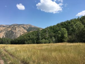
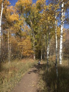
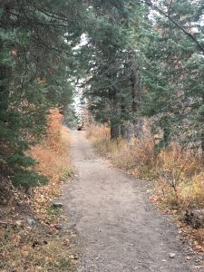
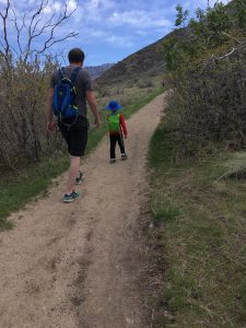
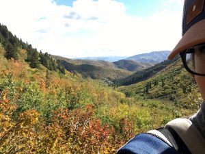
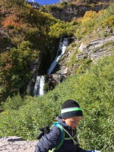
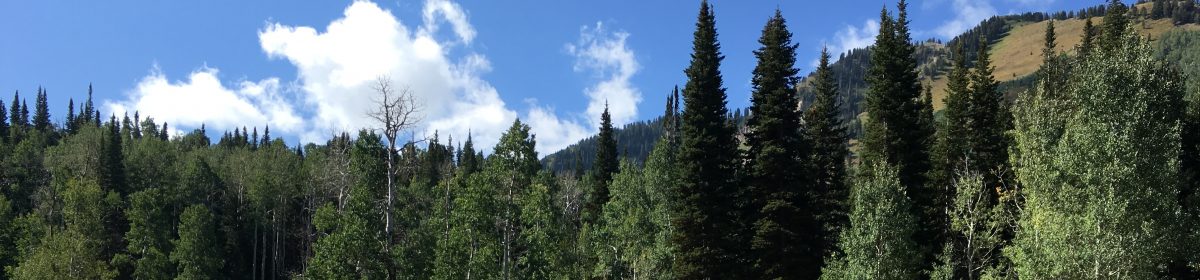
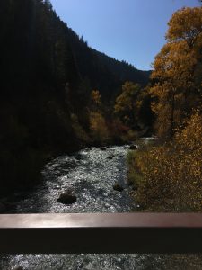
Early in the fall we hiked to Fifth Water Hot Springs. This 5 mile round trip hike is up Diamond Fork Canyon. The colors of the trees and water were fantastic this past year, and the distance was totally worth it.

OVERVIEW

Where: Diamond Fork Canyon, Spanish Fork

Grown up difficulty: easy

Five year old difficulty: moderate due to length

Length and elevation: 5 miles, 780 ft gain

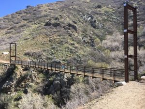
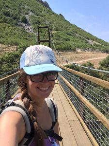
To see: a bridge, the river, hot springs

Busyness: busy

Alltrails: https://www.alltrails.com/trail/us/utah/fifth-water-hot-springs-trail

DETAILS

This trail has become increasingly busy over the last few years. It’s great for day and night hikes, and parking is near impossible on weekends. Our  hiking group went on a weekday morning and even then, parking was difficult to find. There is no cellphone service. Pack up lots of snacks, maybe lunch, and make sure you’re planning for the dip in the pools with extra clothes and towels.

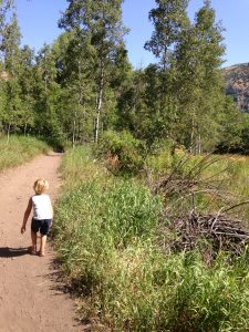
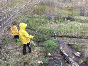
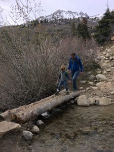
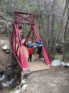
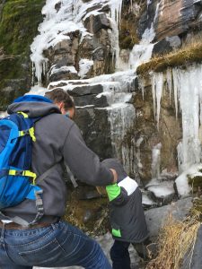
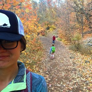
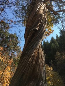
The beginning of the hike has vault toilets. There is a bridge shortly after the beginning-don’t cross it! The bridge you will cross is about a mile to a mile and a half into the hike. There are a couple spots where people camp, and a couple spots where the trail has washed out. Remind your kids to watch their step! We passed a really neat twisted tree on the east of the river.

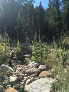
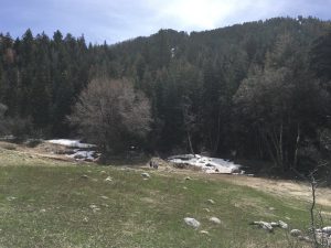
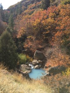
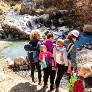
A little over a mile from the bridge, you’ll notice the smell of sulphur which means you’re getting close. The hot springs will be on the right side. There are several to choose from, with the lower ones being cooler generally than the upper ones. This past year, the pools were a gorgeous blue that stood out against the fall leaves.

We spent around 30-45 minutes in the pools before changing and heading down. These springs have become so popular and unfortunately people are not following the guidelines of “leave no trace“. Make sure to pack out what you pack in.

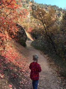
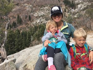
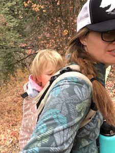
Because of the length of this hike, my kids were exhausted for the last half mile or so. We sang songs and played their favorite games (I spy and 20 questions), but be prepared for whining. And have extra snacks in the car! PS: The road up to this hike closes for the winter, resulting in a 14 mile round trip excursion.

REVIEW

Faves: the hot springs, the bridge

Hardest: the length

Gear: a good carrier (Kinderpack is my favorite), lots of snacks, a backpack for towels and plentiful food, lots of water, fleece and good shoes

Big Spring Hollow

OVERVIEW

Where: Provo Canyon, Vivian Park

Grown up difficulty: easy until last stretch, then moderate

Five year old difficulty: same

Length and elevation: 4.2 miles; 1,177 ft gain

To see: meadows, aspens, bridges, mountain views

Busyness: busy busy

https://www.alltrails.com/explore/trail/us/utah/big-springs-hollow-trail

DETAILS

Big Spring is a family favorite. It’s one of the first hikes I went on after moving to Utah, back when I hated the outdoors. The drive through Provo Canyon and Vivian park is spectacular year round. The springtime at Big Spring is luscious and green. Summer is hot and louder with wildlife around and the full river. In autumn, sounds of rustling and falling leaves surround you. Winter provides more of an opportunity to spot animal tracks while snowshoeing. Sunset and the golden hour are unbelievable here, especially in the big meadow. My brother and his wife took some wedding pictures here and I was so jealous.

You’ll start at a parking lot and head into the forest. Though camping is prohibited, don’t be surprised if you pass some tents. Aspens, Rocky Mountain Maples, and firs will be on both sides of you. There are a handful of trails leading off the side of the main one, but we don’t usually venture off. You’ll cross the river a few times on bridges-my kids look forward to splashing in the water in warm weather. About ¾-1 mile up, you’ll come to the big meadow. On the west is the river, and all around you is waist high grass. Continuing through the meadow, you’ll pass more trees and cross more bridges. Toward the spring the hike becomes steep-but you’re almost there. At the springs a bridge and big rocks will greet you. Here we often have lunch or snacks and explore a bit before heading back down.

Faves: meadow, bridges, final spring (which is now capped, bummer)

Hardest: steepness at the end

Gear: carrier if you have a child that cannot walk the whole trail (Kinderpack is my favorite), fanny pack for snacks and bug spray/sunscreen, water bottle with carabiner to hook to chest clip, hiking shoes or sandals, kids’ hydration pack, hats (check here to see how I carry everything)

Horsetail Falls

OVERVIEW

Where: Alpine, starting from the Dry Creek Canyon parking lot, at the end of Grove Drive

Grown up difficulty: moderate

Five year old difficulty: moderate to difficult, due to steepness

Length and elevation: around 4 miles round trip with a 1800ft gain

To see: dead and decaying horse, huge rock, meadow, aspens and pines, great view of valley

Busyness: medium

All Trails link: https://www.alltrails.com/trail/us/utah/horsetail-falls-trail

DETAILS

This is a steep and beautiful hike. After a short exposed climb (by feet; no rock climbing needed), you’ll enter a forest. A horse died right off the trail in the summer of 2017, and if it’s warm you will smell it. It’s close to the beginning of the forest portion of the trail. Around ½ of the way to the overlook of the falls is a clearing with a massive boulder where my kids like to take a long rest and explore a bit.

Five to ten minutes after the rock is the meadow. Sometimes we call it here, and rest and eat and turn around. Sometimes we continue on. The trail after the meadow is through stream beds, and in the spring will be very wet and muddy. We did this hike at the beginning of November and it was still muddy in parts. The trail splits and rejoins in two or three portions after the meadow as well. You’ll pass over two small streams that cross your path, and one has a log bridge over it, and the other is small enough to step over.

After the streams, there will be a small trail off to the left of the main trail. This takes you quickly to the overlook, where I prefer to stop if I’m hiking with kids. We sit, snack, take pictures, and rest. This spot is visible on Google maps, because the spot is a huge granite block that has no tree cover.

If you want to continue on, you can go back to the trail fork or climb through some boulders ahead. The trail stays steep as you get closer to the waterfall. To get to the base of the waterfall, keep your eyes out for a hard to spot trail on your left. Sometimes there is a rope here to help with the descent and ascent here, since it’s quite steep and has very loose dirt. Hiking through some brush will take you to a place to climb down to the base. If you choose to get in the water, be very careful. I played around in the water with some friends (no kids came with us) and ended up falling hard and sliding down rocks and hitting my head. The rocks are extremely slick due to moss and there is no grip in some areas, therefore I would not take young children down to the waterfall. If you do, be safe.

Another option is to continue on and find the trail that takes you above the waterfall. We did with our children, and while there are great views of the valley, the cairns take you past the waterfall and you can’t see the waterfall anymore. It was a disappointment to us and our kids. Consequently we prefer to stop at the overlook, and everyone is happy.

REVIEW

Faves: the final views, the magical forest the trail goes through, looking out for the trail markers (dead horse, big boulder, meadow)

Gear: shoes with good traction, kids’ hydration pack, walking sticks if you want more support hiking down, carrier, water bottle, snacks on snacks on snacks

Bear Canyon Suspension Bridge

Overview

Where: Sandy, starting from Orson Smith Park

Grown up difficulty: moderate to easy

Five year old difficulty: same

Length and elevation: 2 miles, 450 ft elevation gain

To see: Salt Lake valley, cool bridges, river

Busyness: lightly trafficked to moderately trafficked

https://www.alltrails.com/trail/us/utah/draper-suspension-bridge

summary

One of my friends recommended this hike to me. The alltrails for it looked amazing, so we made a local event and went! It was a blast. The beginning is switchbacks from a neat little kid centered rock climbing park, until you get to the Bonneville Shoreline trail. Then it’s pretty flat to get to the (rather large) suspension bridge. This is a very exposed trail, so dress accordingly.

details

I’ve only ever started at Orson Smith Park which has a couple of covered picnic tables, and a bathroom. To the immediate east is the trail. Several switchbacks have you gain elevation at a pretty good pace. After a few you’ll come to a flat trail. This won’t take you to the bridge-keep going up! The trail continues up more switchbacks until it reaches the Bonneville Shoreline trail.

This trail will take you slightly around the mountain, after passing a sign for Cherry Canyon Logging trail. Stay on the flat trail; don’t go up unless you want a much more intense hike. Pretty soon you’ll start to see glimpses of the bridge. I was stunned when I first saw it because it was much bigger than I expected.

My kids like to give me a heart attack and hop across the bridge. It is fun and a little trippy to walk across the bridge as it sways. We have a good time here and usually have snacks on a bench on the side of the bridge.

Then, we head up to another bridge! This one is just a couple minutes up from the suspension bridge. It’s little and painted red, and right over a small stream my kids like to play in when it’s warm.

When it’s warm out, this is a great shaded place to sit and eat lunch before heading down.

Review

Faves: the suspension bridge! Totally worth the effort to get to it.

Hardest: the switchbacks

Gear: a carrier if your child isn’t ready to hike alone (love my Kinderpack!), hydration pack/water bottles, hiking shoes or tennis shoes, snacks, hats, sunscreen

Timp Falls

Fall colors behind Timp

Quick Look

Where: Alpine Loop, Mt Timpanogos trailhead

Grown up difficulty: easy

Five year old difficulty: easy

Length and elevation: This is a guess-3 miles and 800 ft gain

To see: aspens, mountain peaks, glacier, waterfalls

Busyness: not too busy during school days, busier in summer and on weekends

Note: This link is for the entire Mt Timp summit trail. The waterfalls are only 1-1.5 miles in.

Alltrails link: https://www.alltrails.com/trail/us/utah/mount-timpanogos-trail-from-aspen-grove

Through the aspens

Detailed Summary

This hike is a family favorite for every season but winter-only because we’ve never tried it in the winter. Most of the trail is actually paved, though narrow. You can see the waterfalls from almost the beginning. In the spring, many plants are covered with tent caterpillars. Flowers bloom all along the trail and the little valley behind Timp. There’s decent shade all along, and areas to sit and watch the waterfall once you reach it.

If you continue on past the first landing, you’ll come to a switchback and then to a second set of falls. These are my favorite, as you get a great view of the landscape and the falls are less traversed. I have tried snowshoeing with adults on this trail, but we lost the trail quickly and just played around. Depending on the winter, the trail may be covered with ice and you’ll need spikes or crampons. Usually we can hike this trail from late May through November. In September, be wowed with the changing leaves. It’s wonderful.

Fall colors on the trail

Faves: watching the foliage change through the year, the second set of waterfalls

Hardest: none

Gear: carrier if you have a child that cannot walk the whole trail (Kinderpack is my favorite), fanny pack for snacks and bug spray/sunscreen, water bottle with carabiner to hook to chest clip, hiking shoes or sandals, kids’ hydration pack, hats